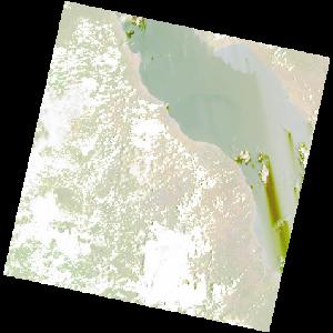
LC09_L2SP_172065_20221027_20221029_02_T1_SR_stac
dataset of product ls9_sr
Indexed by odc_writer
,
created
Region
172065
for
27th October 2022
Fields 🔗
cloud_cover
38.39
collection_category
T1
creation_time
2022-10-27 08:09:57
crs_raw
•
data_coverage
•
dataset_version
•
eo_gsd
•
eo_sun_azimuth
105.296
eo_sun_elevation
65.899
format
GeoTIFF
id
64283c6f-9b2e-5df1-a6b6-c802b7ce739a
instrument
OLI_TIRS
label
•
lat
-8.278 to -6.191
lon
28.647 to 30.672
platform
LANDSAT_9
product_family
•
region
•
region_code
172065
rmse
8.431
rmse_x
5.299
rmse_y
6.557
sat_orbit_state
•
sat_relative_orbit
•
time
2022-10-27 08:09:57 to 2022-10-27 08:09:57
Related Datasets 🔗
LC09_L2SP_172065_20221027_20221029_02_T1_SR_stac